The ArcGIS Survey123 team describes their app as “a simple and intuitive form-centric data-gathering solution” that makes it easy to “create, share, and analyze surveys.” Recent updates welcome our TruPulse® line into ArcGIS Survey123 via practical laser rangefinder data collection workflows.
TruPulse rangefinders join our Trupoint™ 300 Compact Total Station in the list of directly compatible ArcGIS Survey123 rangefinder options. Along with the ability to add height, angle, and distance measurements to surveys, rangefinder workflows remove any need to occupy an asset’s physical location. This opens up opportunities to improve data collection practices in the field.
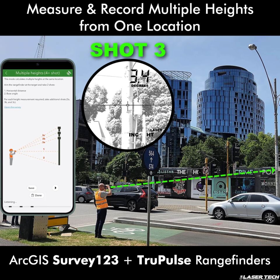
Integrate TruPulse rangefinders with ArcGIS Survey123 to capture multiple heights from one location.
The ArcGIS Survey123 app offers workflows for users to get the most out of integrated rangefinder abilities.
Pick a safe location with your target in sight to remotely capture measurement data and map asset coordinates.

Remote mapping features allow TruPulse and ArcGIS Survey123 users overcome gnss signal issues.
Pick a convenient location that has multiple targets within sight and check them off your list one by one.
If mapping assets in GNSS signal-impaired areas, just log an origin point and let the rangefinder do the rest. Use a receiver to capture a solid signal connection with your asset in sight/range, then aim and shoot. Sometimes, established coordinates of landmarks or monuments can be used as origin points as well.
These resources will help you optimize your experience and results using TruPulse rangefinders with ArcGIS Survey 123:

ArcGIS Survey123 prioritizes user productivity.
Don't want to miss out on future updates? Subscribe to our blog for the latest news, trends, and expert insights from LTI. Head on over to our subscription page to sign up today!
Sign me up!