LaserGIS® Helps Researchers Monitor Wild Medicinal Plant Status
by T. Hart 07/01/22
A recent project funded by the North Carolina Friends of Plant Conservation will enhance scientific understanding of how medicinal ginseng plants may be responding to environmental changes.
Using LaserGIS to Map Ginseng Plants for Scientific Analysis
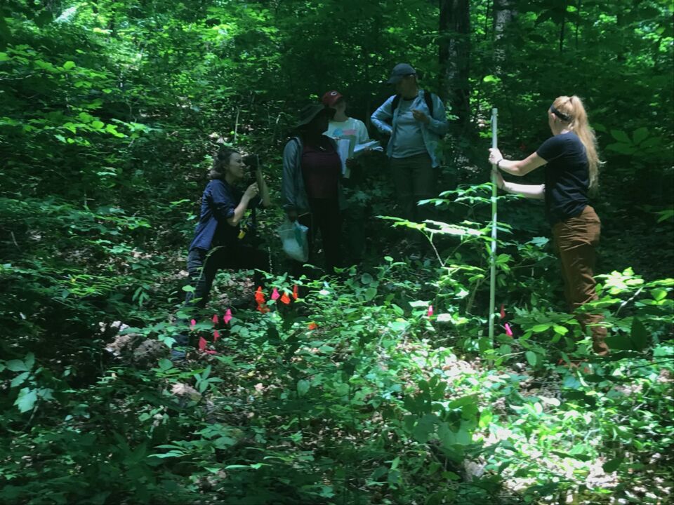
Three North Carolina researchers team up to monitor the populations of these rare and beneficial plants:
Alisa Hove, Ph.D. (Chair & Professor of Biology at Warren Wilson College)
Jennifer Rhode Ward, Ph.D. (Professor of Biology at University of North Carolina Asheville)
Jonathan Horton, Ph.D. (Chair & Professor of Biology at University of North Carolina Asheville)
LaserGIS offset mapping overcomes the obstacle of dense canopies disrupting GPS signals
Their immediate goal has two parts:
Re-locate and validate locations of wild plants that had been tagged nearly 10 years ago
Add new plants to the catalog along the way
Assigning coordinates to the vulnerable vegetation will create universally comprehensible maps that offer valuable data to a worldwide audience. Before the team can achieve this feat, they must overcome two natural obstacles:
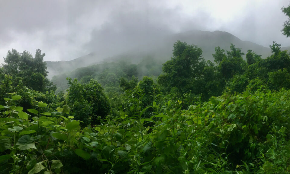
The terrain of study areas is too steep for traditional survey equipment
The forest canopy is far too thick for the team to collect reliable GPS signals
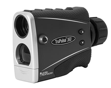
The 360° model laser with its precise internal compass is a perfect instrument for this environment. There are no magnetic disturbances to worry about and the pocket-sized product will measure everything needed to locate points in 3D space
TruPulse Rangefinders and MapSmart Software Overcome GPS Obstacles
Understanding the Project
Research team member Alisa Hove describes the reason for the project:
TruPulse 360° helps map regional ginseng plants
“North Carolina is a state that is rich in plant biodiversity and endemism, and the state’s flora has played a key role in its economic development. At the turn of the last century, wild harvesting of medicinal and ornamental plants helped trigger the development of local economies in western North Carolina.
Over time, however, many plant species in this region, including the popular medicinal plant American ginseng, have declined in number due to a variety of factors, including overharvesting and environmental stress.”
Information gathered from this project will allow scientific communities to evaluate how the rare plant species is responding to regulatory protection, harvesting, and climate change.
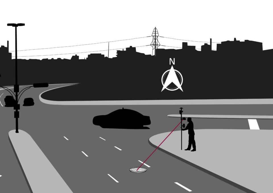
How Distance-Azimuth Offset Mapping Works
Distance-Azimuth is the most simplified LaserGIS offset mapping method
LaserGIS is our term for workflows that measure distance offsets to features by recording both a GPS position and an associated distance/direction to the object of interest.
These techniques offer reliable options to professionals tasked with mapping assets within challenging locations. Of the multiple LaserGIS mapping methods available within our MapSmart data collection app, the team opts to use the Distance-Azimuth method.
The Distance-Azimuth offset mapping routine boasts one key advantage above the rest: coordinates can be assigned at a one-shot per asset cadence. Taking advantage of this simple process requires a TruPulse 360 series laser rangefinder, since its internal compass plays a key role. With the 360 laser connected to your data collection app via Bluetooth®, the Distance-Azimuth procedure requires only a few steps.
Here’s how it works:
Laser Tech’s TruPulse 360 laser rangefinder
Step 1: Log an Origin-Point.
This requires either a solid GPS signal or a set of previously established coordinates*.
*In their GPS challenged environment, the team often uses the established coordinates of forest-monuments as origin points.
Once logged, the origin-point coordinates serve as a point of reference for assets mapped by 360 rangefinders.
Step 2: Aim and Shoot
Use the 360 rangefinder’s scope to acquire your first target, then fire its infrared pulse to obtain measurements. Repeat until all assets within sight have been recorded.
Every new shot measures the Azimuth, Inclination and Distance from your origin-point an asset.
Watch Steve Colburn, our Applications Training Specialist, walk through the Distance-Azimuth LaserGIS routine:
LaserGIS: Making Maps for Today and Tomorrow
All of the team’s rangefinder data transmits wirelessly to the MapSmart app. This runs on their rugged mobile devices. MapSmart records these measurements and draws a map for the user.
The map’s control points and plant locations will remain available for future researchers to utilize. As studies on the region’s ginseng plants continue to evolve, new discoveries will build upon the team’s updated map. Our TruPulse rangefinders and MapSmart app continue to help professionals achieve mapping projects in even the toughest environments.