Dann Block started working at Seattle, Washington’s Woodland Park Zoo in 2016. As their lead gardener. he quickly discovered major data inaccuracies when compiling CAD drawings and GIS inventory of the zoo’s trees into ArcMap® laser offset mapping.
The zoo ranks second for exhibition honors by the Association of Zoos and Aquariums, with their 92-acre of impeccable exhibit doors open to over 1.3 million guests each year. There is no doubt that Woodland Park Zoo constantly evolves their exhibits to achieve such a high number of honors. Achieving these honor-worthy exhibits is no easy task. Every new exhibit requires modifications to the zoo’s infrastructure including possible irrigation valves, water lines, and underground gas line changes.
“With every new exhibit comes changes in how the utilities and infrastructure are laid out,” said Block. Previously, Block had to acquire measurements within the exhibit when planning infrastructure changes for a new exhibit, limiting animals to their sleeping quarters which caused disruption to their daily routines.
Among the struggle to minimize disruptions for the zoo’s animals, Block was dealing with outdated maps and blueprints. Using hand-drawn 1950s maps, CAD, and as-builts, mixed with several tools used for location intelligence over the years, created a questionable map of the zoo’s true infrastructure. Block found himself digging holes only to discover an unexpected object in his path far too often. This persuaded Block to create a new and accurate depictions of the zoo.
“We had tree points in the middle of buildings or pathways. When we added aerial imagery, we noticed that some of the CAD lines were out of date and tree centers were sometimes more than 20 feet outside the canopy of the tree on the image,” Block said. It was a start: however, these maps were nowhere near useable. Block wanted to create a clear infrastructure and a public facing map that showcased Seattle’s indigenous plants, while keeping each exhibit authentic.
With no previous GIS training, Block took advantage of the zoo’s resources to learn how to update the garden inventory by signing up for a seven-day TeachMeGIS.com training and took multiple online courses, when he stumbled upon a YouTube Video about ArcGIS Parks and Gardens Data Model that helped turn his idea into reality.
Inspired, Block chose to use ArcGIS® Collector® to gather data via his iPhone 8. Recognizing the need to improve his mobile location accuracy to real-time high-accuracy location positioning led him to the Eos® Arrow 100 GNSS receiver, performing tremendously under urban canopies.
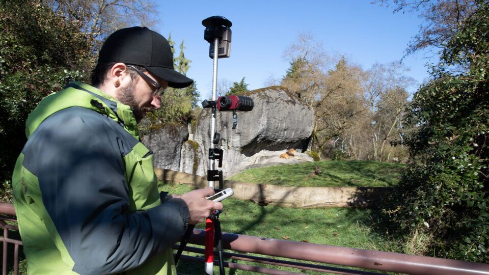
The TruPulse 200X integrated Mapping Solution used by Woodland Park Zoo
To achieve a better view of the sky, Block mounted his Arrow 100 GNSS receiver to a 15-foot telescoping survey pole, and soon found that he couldn’t eliminate the zoo’s biggest challenge of mapping the trees that were obstructing the sky.
The Arrow 100 GNSS receiver’s location point kept lingering around a sizable area when Block was next to the base of a tree, continuously dropping satellite signals even with the Arrow 100 receiver tracking all four global constellations. Block needed to take a step back and map from a distance where he could see clearer skies.
To achieve his accuracy needs and capture his asset points from afar, he needed to integrate a laser rangefinder that fed asset location data into Collector.
“I would like to find a laser rangefinder to map our gardens and infrastructure,” Block wrote to Eos, “most of which is under dense canopy cover.” Eos recommended Laser Technology, Inc., TruPulse® 200X laser rangefinder for a complete laser mapping offset solution. After integrating Eos Arrow 100 GNSS receiver and LTI’s TruPulse 200X into the Collector workflow, he was able to map the trees and infrastructure assets that were located under other trees and buildings.
LaserGIS is our term for using TruPulse laser rangefinders as an integrated tool within workflows that allow users to assign coordinate and characteristic data to assets without physically occupying their location(s).
Block describes how a LaserGIS system creates an immediate convenience in the project:
“It’s a great tool to have. When I’m in dense canopy and I have all these trees, I can just pop back out, get a line of sight, and take my location point from there.”
In addition to the TruPulse 200X, Block also purchased LTI’s Foliage Filter, a lens for filtering out foliage and obstructions so only the target is collected. Block was able to obtain measurements under thick shrubbery where irrigation valve boxes are typically placed.
“The laser range finder is useful anywhere safety is an issue for our workers or equipment,” Block said. “With the laser offset, I don’t have to guess where my points are now. I can get close. Depending on how close I am to buildings, I can get as good as 20 centimeters.”
The cohesive integration of Esri, Eos, and LTI devices facilitates Woodland Park Zoo’s first accurate and up-to-date set of maps. Laser offset mapping is also aiding in the elimination of disruption of the animal’s daily routines by letting Block map and measure from any location. This project is expected to take several years to complete and is creating many viable technological options for the zoo, including a potential app for the public providing the zoo’s layout and plant locations!
Read this mapping article at its entirety.
Contact us today for more information about LTI's offset mapping solutions, or to schedule a practical demonstration.
Contact Us