CENTENNIAL, CO April 28, 2017 – Laser Technology Inc. (LTI), the leading designer and manufacturer for professional grade laser rangefinders and software solutions, has just released LaserSoft® MapSmart® for Android® that makes data collection easier, safer and more affordable.
MapSmart is designed for any forestry, construction or GIS professional who needs to quickly and accurately map, measure, or position features such as trees, street furniture or even telephone and powerline poles. It’s a simple yet powerful program that easily integrates with LTI’s TruPulse and TruPoint laser devices that makes a total data collection solution.
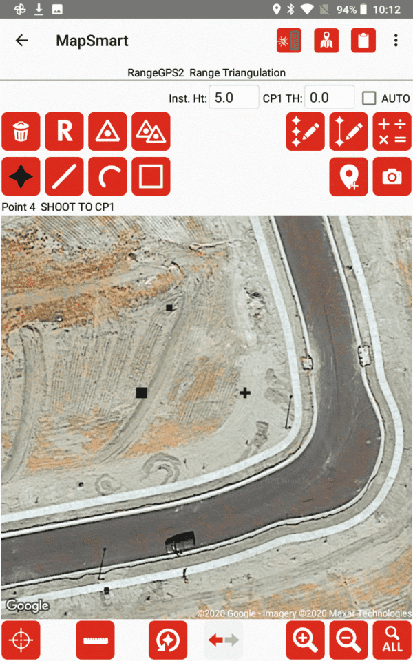
This program was specifically designed to be easy to operate so more time can be spent mapping and collecting data rather than extensive training. Only one GPS coordinate is needed to map surrounding features or landmarks because they can all be mathematically calculated based on that one collected latitude and longitude position established as the origin point. Professionals can choose to use the Android device’s GPS to establish their occupied position for remote offset mapping or can use high-accuracy Bluetooth GPS or can choose to not use GPS at all. The software also includes a complete volumetric calculation solution a no additional charge.
What makes MapSmart on Android uniquely different from other mapping solutions offered in today’s market is that professionals can get from the field to the office in the least complex and most cost effective way. The workflow is designed like modern smartphone apps, is priced very competitively and does not require annual subscription fees.
Having the ability to store field measurements on any Android device and transfer data into any CAD or GIS visualization program makes the MapSmart field software even more valuable. Take measurements and get instant results that can be used in multiple report formats including DXF, CSV, GPX, PDF and more. Users are able to install, update and transfer data without the needs of cables or syncing programs.
With Android-based rugged tablets available today, professionals can work with a much larger display making data collection that much easier and more manageable. Map with point, line, spline and area feature types and build custom notes categories and subcategories. Collect additional height and missing line values to data points and include photos with measurement data.
The MapSmart app is available now on Google Play. Worldwide users can simply search for “LaserSoft” or “LaserSoft MapSmart” from a smartphone in order to purchase and download. It is offered in English, but translation templates are available in order to support an international audience.
Contact us today for more information on LTI's mapping devices and software, or to schedule a practical demonstration.
Contact Us