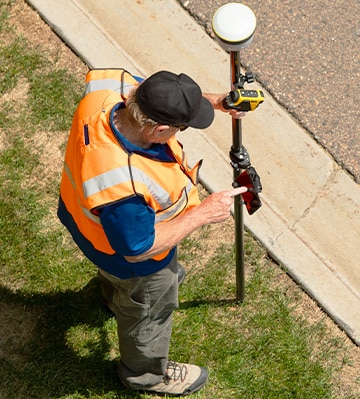
Laser Technology Inc. releases the all new LaserSoft® Connect App to bring all capabilities of the world-renowned TruPulse® laser rangefinder series into ArcGIS Field Maps, for use with Android devices while boasting connectivity to all brands of GPS equipment, with no restrictions.
Access the Press Release as a PDF

The LaserSoft Connect app empowers ArcGIS Field Maps users to utilize TruPulse rangefinders as a means of sticking to safe and convenient locations.
ArcGIS Field Maps users can now build maps and perform accurately detailed data collection with the advantage of TruPulse rangefinders at their side. Every rangefinder measurement includes values for range and inclination. With 360 models, azimuth will also be measured. This data can calculate remote location coordinates for targets and remove any need for users to occupy a target’s location. Log your current position and then use your rangefinder to locate targets within a clear line of sight. Other applications of rangefinder data include height measurements and horizontal, vertical, and slope distance measurements.
“We proudly invite members of the Esri community to equip themselves with the free LaserSoft Connect app. Bridge TruPulse rangefinder capabilities with ArcGIS Field Maps to enrich project data and deploy the convenience of LaserGIS® offset positioning workflows with all types of GNSS equipment.”
– Steve Colburn, Application Training Specialist at Laser Tech
Laser Tech is proud to help Geographic Information System (GIS) professionals expand their ability to overcome signal issues, dangerous terrain, private property, and other potential mapping challenges. Along with these advantages comes the potential to boost efficiency in the field; the LaserSoft Connect app ensures all your equipment is LaserGIS®-ready by connecting the equipment you have with your TruPulse laser rangefinder. Rangefinder workflows speed project completion when you position multiple assets from a single safe location, cutting down on access and traverse time.
Visit LaserTech.com to review specifications and download the LaserSoft Connect app via the Google Play store.
Laser Technology, Inc. is a Colorado-based manufacturing and design company for innovative laser-based speed and distance measurement instruments to address real-world needs and applications. Laser Tech’s TruPulse® laser rangefinders allow field crews to accurately measure distance, height, and elevation safely and efficiently. When paired with Laser Tech’s LaserSoft® apps, professionals can easily streamline workflows and document every measurement captured. Learn more at www.lasertech.com.
Don't want to miss out on future updates? Subscribe to our blog for the latest news, trends, and expert insights from LTI. Head on over to our subscription page to sign up today!
Sign me up!