Crash investigation and reconstruction professionals do not have it easy. Not only are forensic measurements themselves open to full scrutiny by courts, but appealing to a jury usually means visualizing the data through Computer-Aided Design (CAD) programs. As advanced as modern CAD programs may be, they are still only as good as the data they receive.
Optimizing time consumption and personnel use can be important elements that don’t show up on forensics reports. There can also be x-factors to work around, like weather and time of day, which is especially true with outdoor scene mapping. Troublesome as these aspects may be, it is important to make sure that nothing gets in the way of quality data collection. Building a versatile and diverse crash and crime reconstruction toolkit is one of the best ways to adhere to this rule.
There is a wide range of tools available to crash investigation and reconstruction professionals. Everyone has their favorites, but there is no single tool that remains perfect for every single mapping situation. Understanding the pros and cons that come with each option, from traditional tape measures to our TruPulse laser rangefinders and even highly sophisticated 3-D total stations, is a tool in itself. In that spirit, this article argues that crash and crime reconstruction professionals should adopt the phrase “the more tools, the better,” and aims to tell you why, one tool at a time.
Here is a breakdown of seven different options that can help boost your crash investigation and reconstruction toolkit’s versatility:
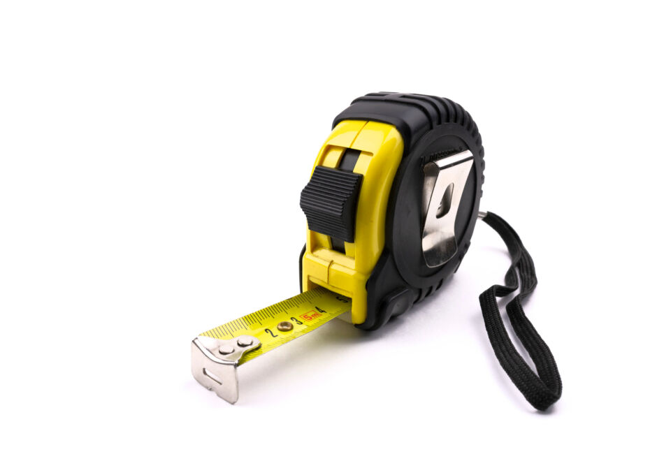
Tape measures are no longer the best tool for crash investigation and mapping, but they still have benefits to offer.
This is one of your traditional measurement methods. Use an expandable and physically marked tape to measure distances between two points.
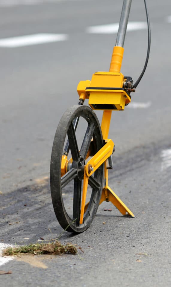
Measuring wheels can come in handy, though non-flat surfaces and curbs can cause inaccurate distance measurements
Keep a tape measure or two readily available whenever crash or crime mapping is needed. Do not use it to map your whole scene, especially if animation is a goal. Still, it can come in handy more than you might expect, it remains a great option for short-range measurements and device calibration routines.
The Advantages and Disadvantages of Tape Measures
The 6 Best Tape Measures of 2023
This classic and simple method of documentation includes taking multiple photographs of the scene from ground level and using known measurements to determine proper scaling and other mathematic information.

Ground-level photogrammetry is a simple method of crash investigation that functions best as a visual complement to more detailed reports.
Why not? Although this is quickly being replaced by drone-based aerial photogrammetry, if the situation allows for ground-based photogrammetry, it cannot hurt to include the practice with your other, more sophisticated mapping and reconstruction methods.
Photogrammetry – History and Modern Uses
These electronic devices use eye-safe reflectorless lidar technology to gather angle and distance measurements from a single, sighted target at a time. Integrate laser rangefinders with GNSS technology to include offset positioning functionality.
Crash investigation and mapping with Laser Tech (LTI) laser rangefinders is one of the simplest methods that maintain primary source accuracy while integrating into other datasets with ease.
Mapping with TruPulse laser rangefinders, especially within specifically designed crash and crime reconstruction software like LaserSoft QuickMap 3D, is an easy way to create accurate point-based datasets that can easily integrate into and enhance another method’s findings or function as primary sources on their own.
The Do’s and Don’t of Mapping: Life-Saving Tips
Revolutionizing Crash Reconstruction with Drones and Lasers
TruPulse 200 Series Heigh Measurement Accuracies
These typically small and portable aerial devices continue to grow in popularity and functionality every day, advancing the practice of aerial photogrammetry to the forefront of crash investigation and reconstruction. Use a pre-programmed flight plan or free flight via remote control to gather photos from above with metadata & GPS info included.
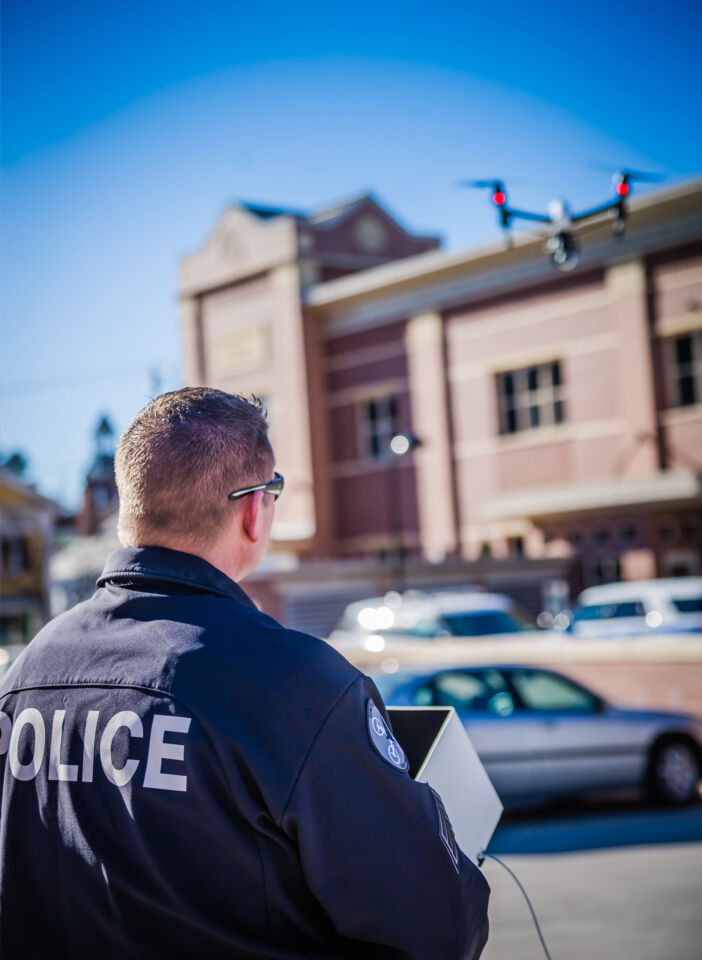
Drones offer a time-efficient and versatile method of capturing crash investigation data via aerial photogrammetry.
There are many reasons why nearly every crash investigation team has drones in their arsenal, between the speed at which a fairly large scene can be captured with high detail, the ability to pre-plan flight paths for autonomous completion, and the integration-ready nature of the photogrammetry data, the question isn’t so much “are drones right for me?” as it is “which drone is right for me?”
Drone Mapping Webinar: Aerial and Ground Measurements
How to Choose the Best Camera for Photogrammetry
The 13 Best Drones You Can Buy in 2023
Very similar to their robotic alternatives, these electronic devices capture exceptionally accurate angle and distance measurements, but they require a second operator to physically occupy an asset’s location and hold a prism for the instrument to target in on.
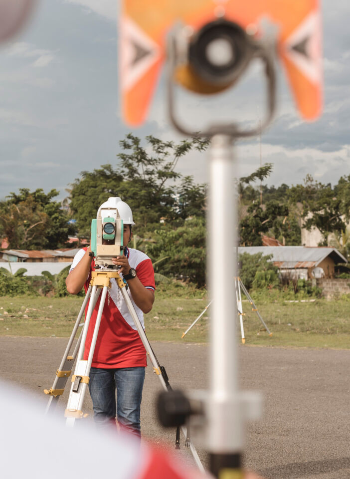
Reflectorless total stations achieve very high accuracy, much like their more expensive robotic alternatives, but require two operators.
If you can’t afford a robotic total station but still want exceptional accuracy, and have the personnel for two-person operation, look no further than reflectorless robotic stations!
Mechanical vs. Robotic Layout: Is a Robotic Total Station Really Worth It?
From Manual to Automated Surveying: How to Pick the Right Total Station
The Ultimate Buyers Guide to Total Stations
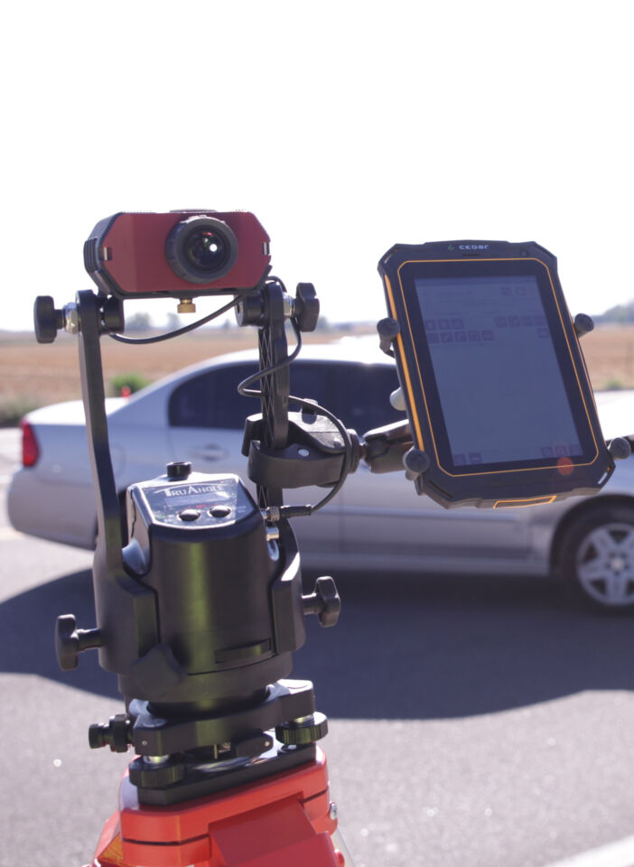
These electronic instruments use optic positioning to measure vertical angles, horizontal angles, and distances from the instrument to visual targets and can be remotely operated by a single user while achieving some of the highest accuracy available.
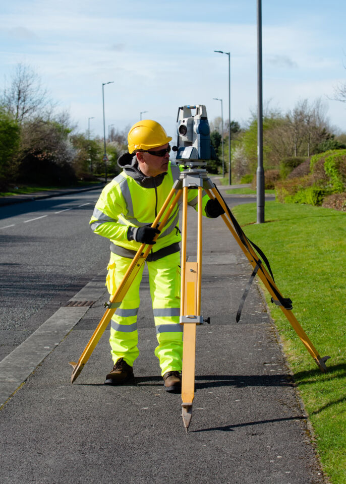
Robotic total stations are very expensive but offer exceptional accuracy to crash investigation and mapping professionals.
If you can afford it, adding a robotic total station to your crash investigation and reconstruction toolkit is a no-brainer. The output versatility and accuracy achieved during data point collection are often considered to be worth the price.
How do robotic total stations work?
Everything you need to know about Robotic Total Stations
These electronic devices capture and render an environment and its features as three-dimensional visual objects.
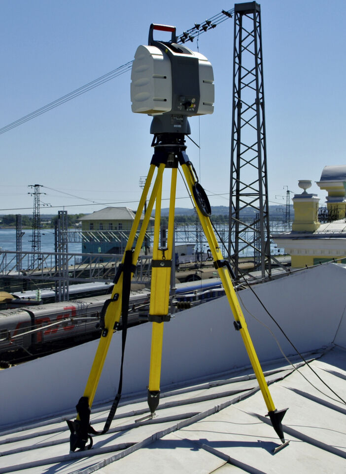
3D laser scanners represent the most technologically advanced, and most expensive, option available to crash investigation and reconstruction professionals.
If you can afford it, 3D laser scanners are top-of-the-line and capable of generating amazingly detailed and accurate renderings of crash and crime scenes.
What Are The Benefits Of 3D Laser Scanning
3D Laser Scanners: A Buyer’s Guide for Professionals
Top 3D Scanning Software Options of 2023
There are many reasons to keep your crash and crime mapping toolkit diverse and full of options. For one, there is the ability to integrate multiple data collection methods into one comprehensive report. This not only verifies your findings but opens up different angles, literally, for data analysis. Aside from this, you want to stay prepared for different situations.
In a perfect world, crash investigation and reconstruction professionals would be able to bring all their tools to every scene, but this is not realistic. More often than not, each scene’s unique situation will need to be weighed against your available tools and personnel. With this general rule in mind, the more options you have, the better.
Explore our mapping kits designed specifically for traffic safety professionals.
Laser Tech Crash and Crime Mapping Kits